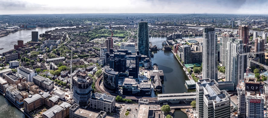
Aerial Still Photography requires using drones equipped with gimbal stabilised still cameras to capture data from a unique aerial perspective gives you a stunning perspective and creates a lasting impression.
Aerial photography lets you get a unique perspective of your property that was until recently impossible. Capturing the surrounding location of the property with aerial shots is an invaluable asset to potential buyers. It is as well a great tool for Architects’ portfolios, capturing all the beauty of your buildings.
You need your Project to stand out with Aerial video footage that captures the moment perfectly and is perfect for taking your audience’s breath away.
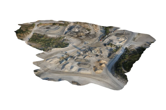
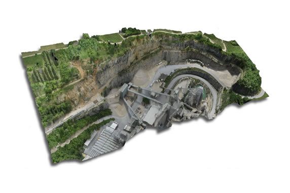
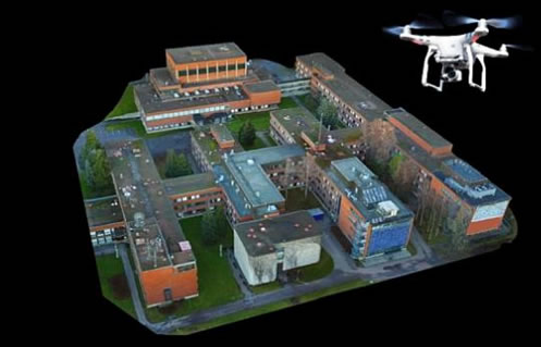
3D Aerial Mapping
Genesis 4D use aerial and terrestrial imagery and laser scan point cloud data to create accurate 3D models of buildings, structures, land and materials. These can be used to inform the design process and allow clients to see new designs in their real-world context.
External Marketing
Aerial Still Photography requires using drones equipped with gimbal stabilised still cameras to capture data from a unique aerial perspective gives you a stunning perspective and creates a lasting impression.
Aerial photography lets you get a unique perspective of your property that was until recently impossible. Capturing the surrounding location of the property with aerial shots is an invaluable asset to potential buyers. It is as well a great tool for Architects’ portfolios, capturing all the beauty of your buildings.
You need your Project to stand out with Aerial video footage that captures the moment perfectly and is perfect for taking your audience’s breath away.
Internal Marketing
Still photography and video services form a unique perspective to your marketing needs.
Showcase your finished development from any angle, we provide expert advice on how to get the best from your NEW Development and highlight its unique selling points.
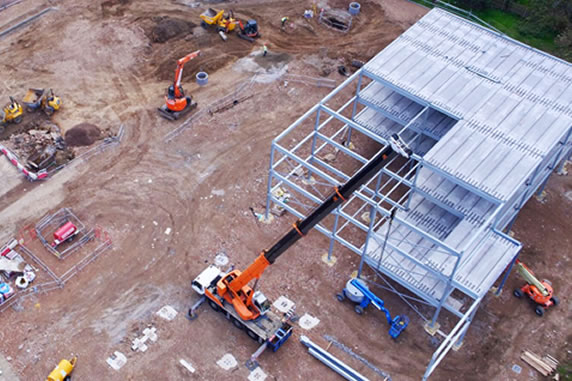
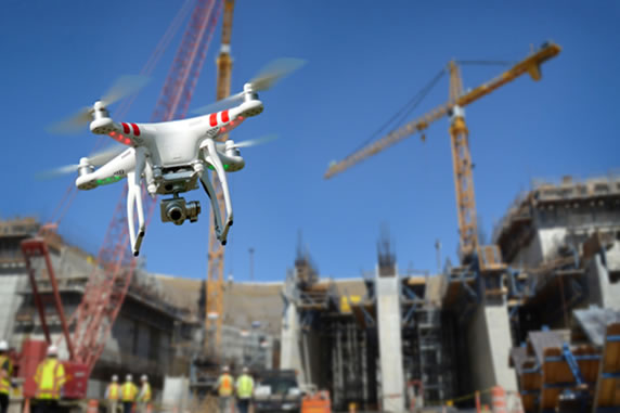
Site Maintenance & Inspections
High-up structures such as bridges, towers, roofs and scaffolding, can often involve costly access arrangements, and site personnel working at height, therefore mitigating the need for costly access solutions and working at height.
Carrying out site inspections on a busy construction site can dangerous and complicated.
A Drone can carry out a visual inspection of high-risk areas can save time and reduce H&S risks.
Drone footage can be recorded from a safe position and then sent to the project team in HD.
3D Aerial Mapping
Genesis 4D use aerial and terrestrial imagery and laser scan point cloud data to create accurate 3D models of buildings, structures, land and materials. These can be used to inform the design process and allow clients to see new designs in their real-world context.
HEALTH & SAFETY SITE INDUCTIONS/INSPECTIONS
Site safety inspections can be more efficient and beneficial by using a drone to fly over a site and review the site issues with both video and stills highlighting any issues in a clear and concise manner and relating these back to the on site sub-contractors and site team.
Site inductions can often be a tedious exercise. Often involving a premeditated talk in the site cabin or a pre-recorded induction video…
Using a drone to fly over a site can show new site operatives H&S risks in real-time. Enabling site managers to demonstrate moving vehicles, moving cranes, or active excavation areas etc.
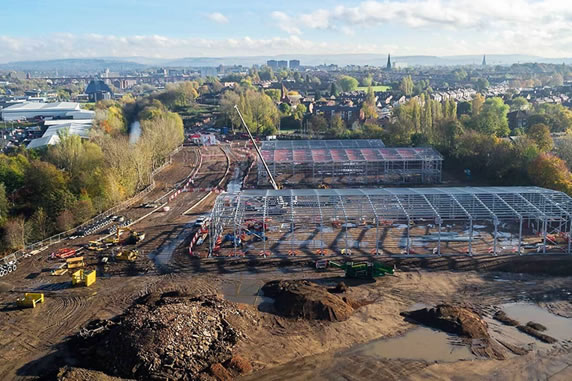
Construction Logisitcs
Construction sites are ever evolving and the movements on-site don’t always stick to programme.
Drones can provide a real-time update of what is going on around the site. Carrying out a speedy flight around the site can give a good overview of potential issues to be aware of. For instance moving vehicles, machinery or cranes etc.
Surveys
LAND SURVEYING
Genesis4D can offer a total air and ground based surveying solution, by combining the use of UAV’s with traditional surveying methods and equipment including laser scanners, total stations and GPS rovers.
BUILDING SURVEYS
Building surveys require visibility of the buildings roof to identify its condition and assess any defects.
In most instances getting access to a roof can be tricky and often involves the erection of a scaffold, use of a cherry picker or ladders.
Using a Drone to perform the survey can save time, money and reduce health and safety risks involved with surveying a roof and other tricky areas.